GIS: Analysis of Dam Purposes
Graduate project using data and mapping programs + design to create a research-backed poster.
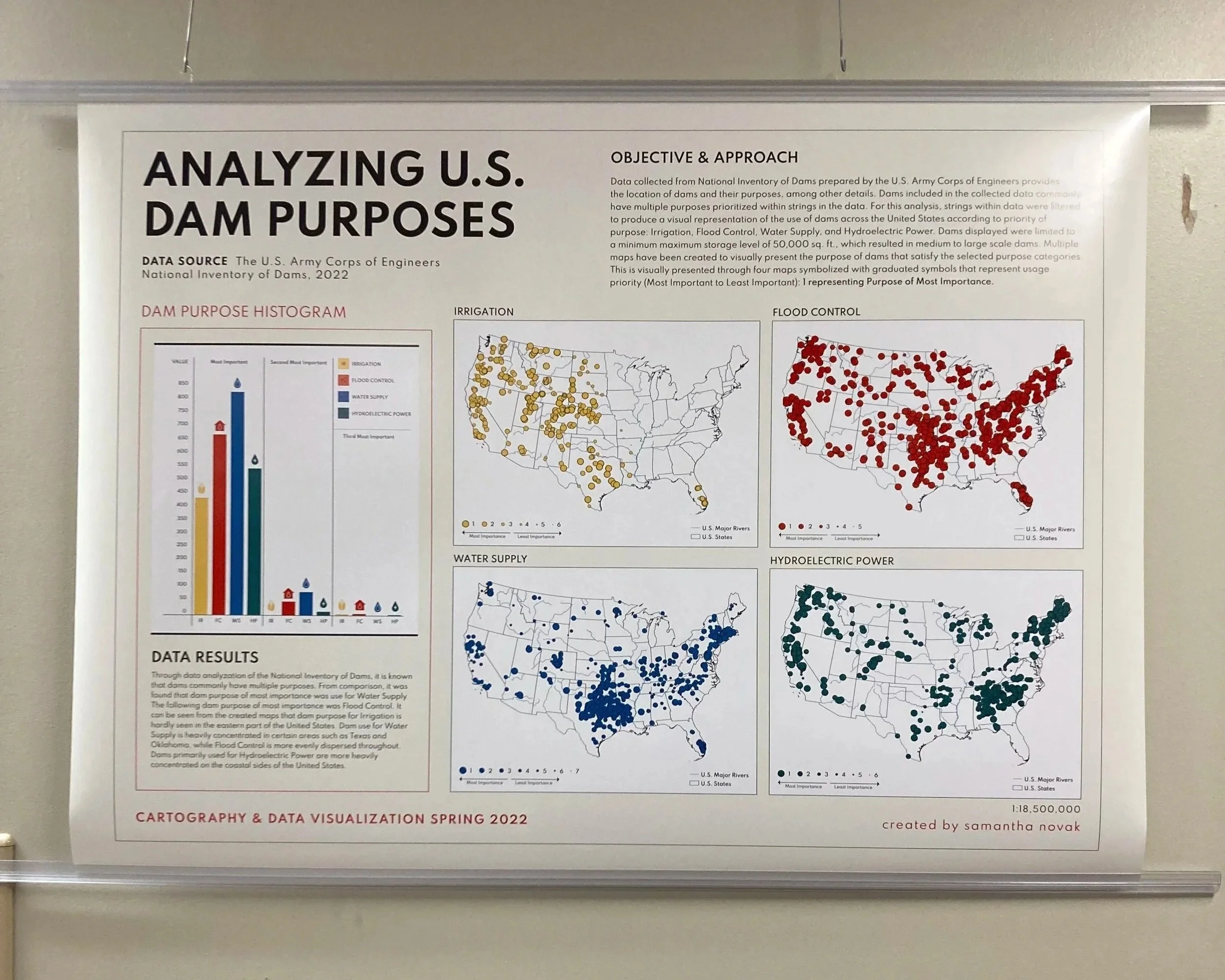
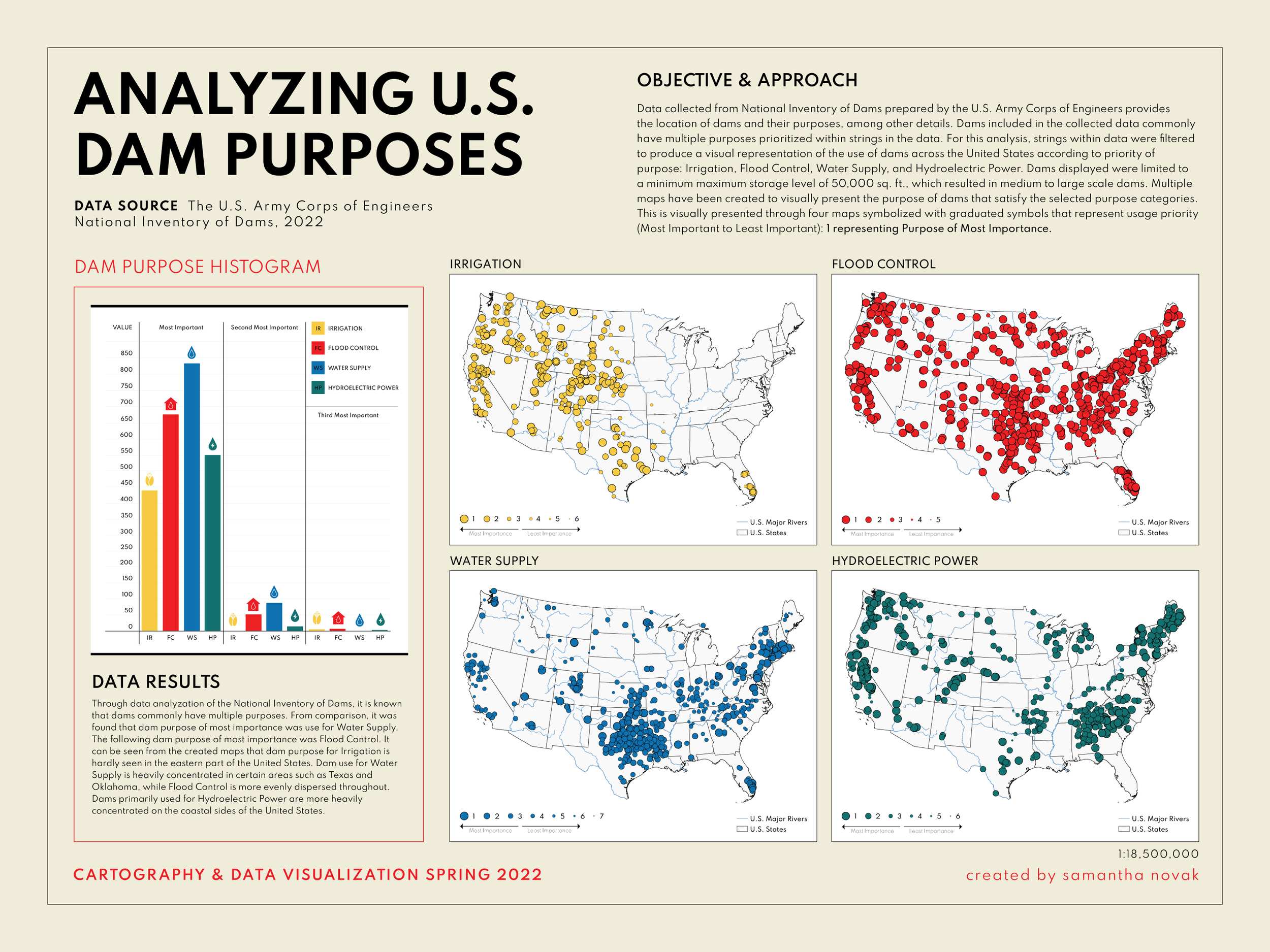
Dams included in the collected data commonly have multiple purposes prioritized within strings in the data. I filtered strings to produce a visual representation of the use of dams across the United States according to priority of purpose: Irrigation, Flood Control, Water Supply, and Hydroelectric Power. Multiple maps used to visually represent primary purpose of dams that satisfy the selected categories and then compared.